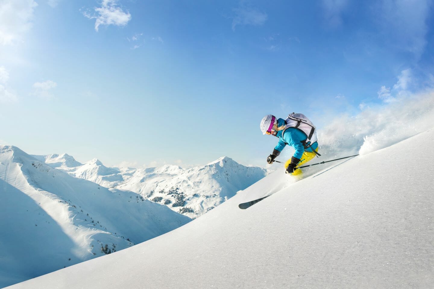

The good news for winter sports enthusiasts first: nowadays, avalanches are scientifically investigated in detail and their origin can be traced back to a combination of different factors, which are also statistically recorded. The bad news is that dozens of alpinists and skiers still die in avalanches every year despite being very skilled and experienced in mountain sports.
When we talk about risks, we implement the possibility of risk reduction. In his life’s work, the author, Werner Munter, has dealt with the assessment and reduction of avalanche risks. With this expertise, he presents an easy-to-use method to transform the complex interplay of different risk factors during a ski tour into a simple yes/no decision.
ACCIDENT PREVENTION INSTEAD OF OPTIMISATION OF THE SALVAGE OPERATION

But what is risk reduction in avalanche-prone terrain all about? Here, Munter warns that the goal cannot be „zero deaths” since the unmanageable residual risk alone prevents this goal from being achieved.
So, it is not to minimise the absolute number of victims, but to optimise the relationship between risk and avoidance.
Since every area of life is associated with a certain risk and we consciously or unconsciously take risks everyday, it is the reduction method’s job to quantify the avalanche risk and make it visible to provide people with a decision-making basis to decide whether to ski the slope or not.
However, it is also crucial that the method aims to avoid an accident rather than to minimise the consequences of the accident. There are tools such as avalanche airbags, transceivers, probes and shovels that are available to rescue and care for accident victims in order to reduce the impact of the accident on a body.
However, the physical forces of an avalanche are so great that some of the buried victims are already crushed during the burial and another large proportion suffocate before the helpers can reach them. For these reasons, the priority is clearly to generally avoid burials.
REDUCTION METHOD: RAPID ON-SITE DECISION-MAKING FOR PROFESSIONALS
The reduction method attempts to quantify the factors that increase the risk of an avalanche and to provide a simple „to go or not to go“ decision by using a formula.
The reduction method is divided into the risk factor that results from the avalanche report and the reduction factors (RF) that represent statistically significant risks:
Residual risk = risk factor ÷ (RF steepest slope × RF avoidance of sectors × RF group size and distance)
The calculation method makes it quick and convenient to assess the conditions. Applied consistently, it reduces the risk of accidents to a minimum (residual risk). If the residual risk is less than/equal to 1, going down the slope is possible, but if the residual risk is greater than 1, the slope should be avoided.
DANGER LEVEL AND RISK FACTOR
According to the avalanche report, a low danger warning level is assigned to a risk factor of 2, a moderate one is a risk factor 4, a significant one is a risk factor 8 and a large one theoretically gets a risk factor 16.
The risk factor for the greatest danger level is therefore theoretical because it cannot be sufficiently minimised by the available reduction factors.
Instead, it is recommended to move in areas with a moderately steep incline of under 30° when there is a high avalanche risk. Intermediate steps are also possible between the danger levels.

OVERVIEW OF THE DANGER LEVELS:
| DANGER LEVEL | SYMBOL | SNOW COVER | AVALANCHE TRIGGER | INFORMATION FOR WINTER SPORT ENTHUSIASTS |
|---|---|---|---|---|
| 5 Very high |  | The snowpack is poorly bonded and largely unstable in general. | Numerous very large and often extremely large natural avalanches can be expected, even in moderately steep terrain. | Very unfavourable conditions. Avoidance recommended. |
| 4 High |  | The snowpack is poorly bonded on most steep slopes (>30°). | Triggering is likely, even from low additional loads (one person), on many steep slopes. In some cases, numerous large and often very large natural avalanches can be expected. | Unfavourable conditions. Lots of experience in avalanche assessment required. Limiting to moderately steep terrain (<30°) / pay attention to the avalanche run-off areas. |
| 3 Considerable |  | The snowpack is moderately to poorly bonded on many steep slopes (>30°). | Triggering is possible, even from low additional loads (one person), particularly on the indicated steep slopes. In certain situations, some large, and in isolated cases very large, natural avalanches are possible. | Partly unfavourable conditions. Experience in avalanche assessment required. Avoid steep slopes of the indicated exposure and altitude as much as possible. |
| 2 Moderate |  | The snowpack is only moderately well bonded on some steep slopes (>30°); otherwise well bonded in general. | Triggering is possible, primarily from high additional loads (group of people, snowmachine, explosives), particularly on the indicated steep slopes. Very large natural avalanches are unlikely. | Mostly favourable conditions. Careful route selection, especially on steep slopes of the indicated exposure and altitude. |
| 1 Low |  | The snowpack is well bonded and stable in general. | Triggering is generally possible only from high additional loads (groups of people, snowmachines, explosives) in isolated areas of very steep, extreme terrain. Only small and medium natural avalanches are possible. | Generally safe conditions. |
AVAILABLE REDUCTION FACTORS
The following reduction factors are provided as precautionary measures to minimise the risk of accidents.
- First class reduction factor: steepest slope (selection is obligatory for the significant danger level)
- RF = 2: less than 40°
- RF = 3: about 35°
- RF = 4: less than 35°
- Second-class reduction factor: avoidance of sectors (not applicable for wet snow)
- RF = 2: frequented slopes
- RF = 2: avoidance of the north sector (NW – N – NE)
- RF = 3: avoidance of the northern half (WNW- N – ENE)
- RF = 4: avoidance of all critical slopes and altitudes mentioned in the avalanche report
- Third-class reduction factor: group size and relief distances (min. 10 metres in the ascent, more in the descent)
- RF = 2: large group (over 4 people) with relief distances
- RF = 2: small group (2 to 4 people) without relief distances
- RF = 3: small group (2 to 4 people) with relief distances
GO/STOP DECISION
If the ratio of risk factor and the product of the selected reduction factors is less than or equal to one (<=1), the slope can be travelled with a low residual risk. In the event of a result greater than one (>1), the decision is negative. You will need to find a way to avoid the slope on a less dangerous route or to abort the tour.
However, the main pitfalls of the reduction method are incorrect assumptions by the user. If the situation on site or, for example, the steepness of a slope is incorrectly estimated, the calculator will also deliver a distorted result. Thus the calculator cannot replace long term experience and a sharp power of observation. In addition, even with a residual risk of less than or equal to 1, you can rely on your gut feeling and choose to STOP.

AVALANCHE RISK AS A COMPLEX RISK
The avalanche risk is an aggregated risk that is composed of individual factors to form a cluster risk. For his model, Munter includes the weather and snow conditions as the first factor, the terrain as the second and the human as the third factor.
On closer inspection, these three factors can be assessed on aggregates of different sizes. Accordingly, they are complex and can only be evaluated with good, experienced and unclouded judgement. In the following, I will explain how Werner Munter’s risk reduction method can work in practice.
3X3 FILTER METHOD ACCORDING TO WERNER MUNTER
In his 3×3 method, Munter focuses on the three risk factors (criteria) to avoid avalanches: conditions, terrain and human.
However, he is not satisfied with a simple assessment of these three criteria alone, but adds 3 additional filters that help to keep an eye on different perspectives and to include different dimensions of risk.
The three filters refer to the regional conditions, local characteristics that can be viewed locally and zonal events that focus on individual slopes and situations. Munter then combines these three criteria with the three filters and gets a holistic image of the risk situation.
The following section provides an overview of the resulting fields of Munter’s risk matrix.
CONDITIONS (WEATHER AND SNOW) X REGIONAL
There is no doubt that looking at the weather provides important information for assessing the avalanche risk. The regional view refers to the analysis of the avalanche situation report, the weather report, the information provided by local experts and trusted persons on-site, as well as information from other local sources.
The avalanche situation report provides information about the entire situation on-site and at different altitudes. The information contained therein about snow depth, the development of the snow profile as well as special dangerous situations provide a good overview of a region and can therefore be used as basic knowledge, for which ski tours and alternatives can be considered.
The weather forecast can also be considered to gain more information about the stability of the condition as well as further developments.
Snow experts on site can provide information about possible specialities of the local landscape thanks to decades of experience in assessing the situation in a valley/region.
CONDITIONS (WEATHER AND SNOW) X LOCAL
The local filter denotes all information from the immediate vicinity on a tour, i.e. everything that’s in sight. This includes local snow conditions as well as the terrain, wind transport, critical amounts of new snow and alarm signals.
The local filter can be used to check the information from the avalanche situation report and to calculate the developments and tendencies. The local weather also has a significant influence on future developments. The observation criteria are visibility and cloud cover, wind, precipitation and temperature.
Our altitude calculator shows how temperature, air pressure and UV radiation normally change depending on altitude. On tour, it can also help to follow the weather forecast with the help of a barometric altimeter.
CONDITIONS (WEATHER AND SNOW) X ZONAL
The zonal filter now draws the radius even closer and focuses the view on individual slopes. It is essential to constantly check the amount of new snow with regard to snow accumulation. What is the view like from the slope, are there warming rays from the sun? Which snow surfaces are joined, how big would a possibly outward jutting snow slab be?
TERRAIN X REGIONAL
The standard for viewing the terrain when planning tours or possible alternatives is a topographical map on a scale of 1:25,000 (to the scale calculator). In many areas, there is also a wide range of guidebook literature to help you find worthwhile touring opportunities and imminent dangers.
In some cases, or when there are no topographical maps available, aerial photographs provide important terrain information. Of course, our own terrain knowledge is also included in the analysis.
TERRAIN X LOCAL
Here, the focus is on comparing the planning information with the local situation: do my expectations correspond to the actual terrain? Binoculars are useful for checking relief, the dimensions, exposure, steepness and, if necessary, the existence of ski tracks.
Especially in the case of tracks that have already been laid, you must check whether these have been laid while considering the terrain information or whether they may have been laid over dangerous passages and require an adjustment.
TERRAIN X ZONAL
With a view of the nearest environment, the following is checked: what is above/below me? Where is the steepest slope, what is the exposure of a slope, am I close to a ridge, what are the altitudes and what is the shape or relief of the slope?

HUMAN X REGIONAL
A relative novelty in Munter’s risk reduction method is the inclusion of the human factor. He queries the dynamics and requirements of the group, since this provides information about the motivation and willingness to take risks.
From a regional perspective, the planning analyses which people are participating in the tour and what their physical and psychological conditions are. What equipment does the group have and how much experience do individuals have? Are all the group members at the appropriate level for the difficulty of the ski tour? Who is responsible?
HUMAN X LOCAL
The local view is specifically about the constant routine retrieval of data on tour: who is in my group, how do performance and mood develop? What about the equipment, was the avalanche beacon checked? Who is still on the go, is there a need to make arrangements? Is the group still on schedule (to the walking time calculator) or do alternatives have to be used if necessary?
HUMAN X ZONAL
This is specifically about the state of mind in the group and the behaviour of other groups on the mountain.
- How are the participants’ fatigue, discipline and ski technique?
- Was the wind chill underestimated and does is present a risk of hypothermia?
- Is a slope constantly used by other groups and, if so, less risky?
- How can the leadership tactics be adapted, do distances have to be maintained, corridors bridged or tracks traced?
- Is it necessary to set up waiting facilities or avoid certain slopes?